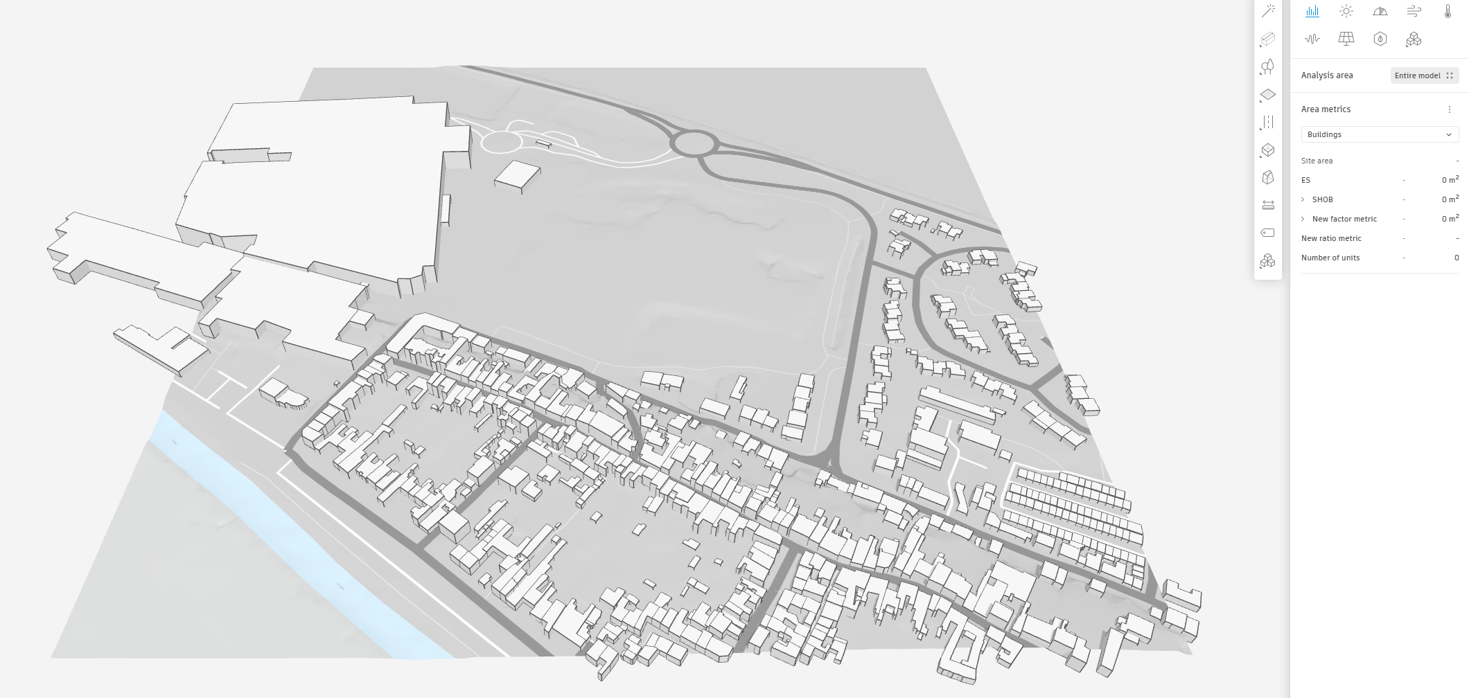
Development
In the initial stage, the available data will be uploaded into Autodesk Forma, setting the foundation for a thorough and informed design process. This includes relevant site information, such as topography, existing infrastructure, and environmental data, as well as any project-specific parameters and constraints.
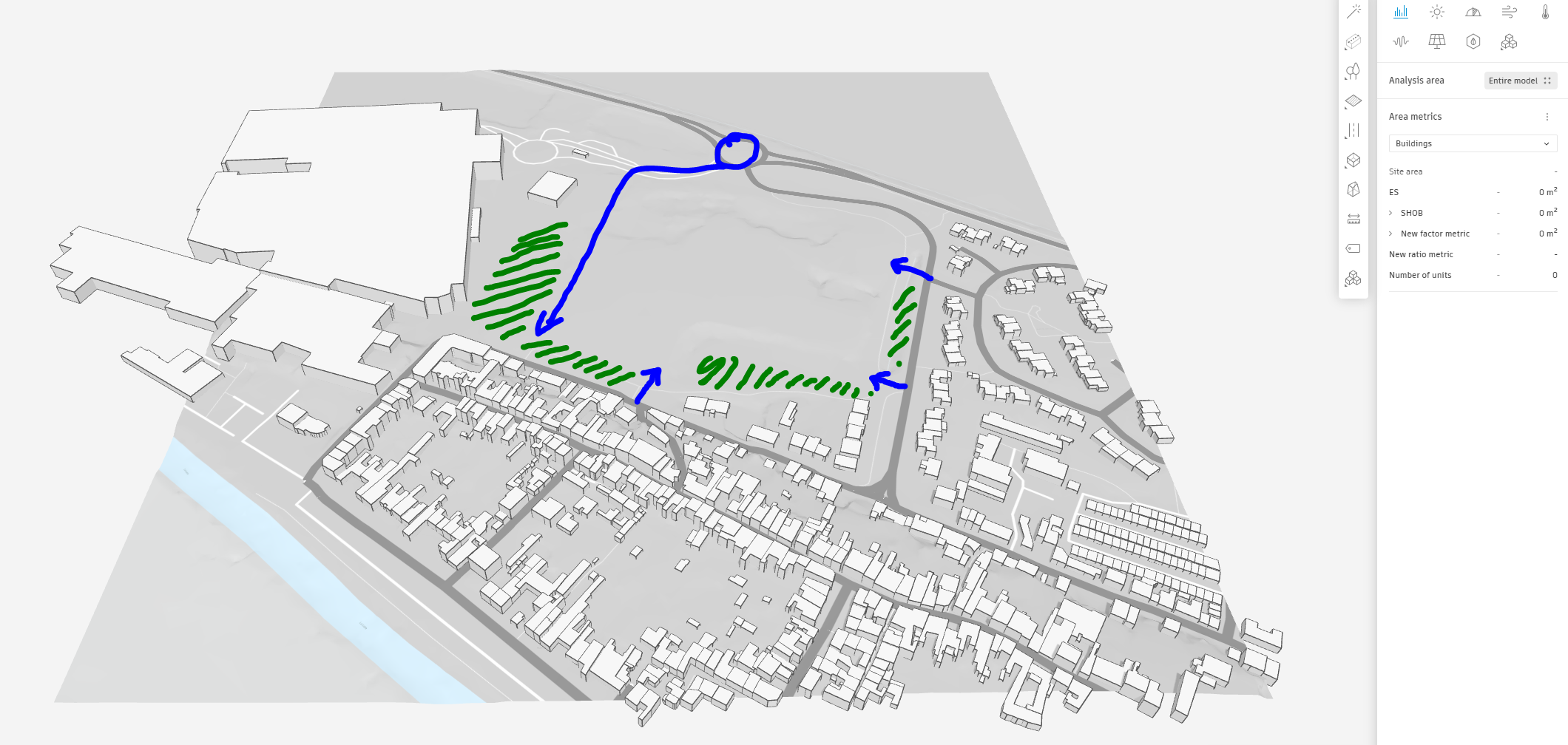
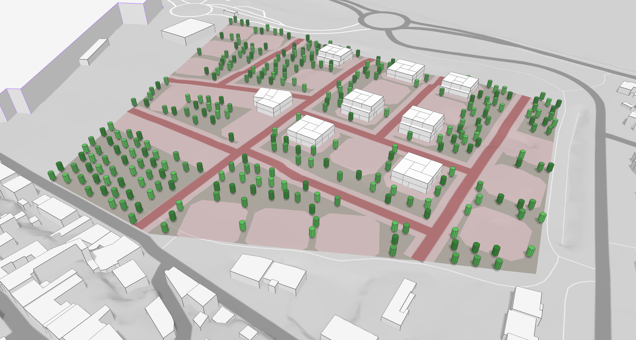
Establishing principles for circulation, access, and distribution early in the design process is crucial for ensuring efficient and user-friendly movement throughout the site. This includes identifying the optimal placement of access points, pathways, and connections to existing infrastructure, as well as considering potential challenges or constraints related to the site’s context. Equally important is the designation of vegetated areas to serve as a buffer between the new dwellings and existing residences, mitigating potential nuisances such as noise or visual pollution. These green spaces can also contribute to the overall quality of life for residents by providing recreational areas, promoting biodiversity, and enhancing the site’s aesthetic appeal.
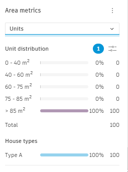
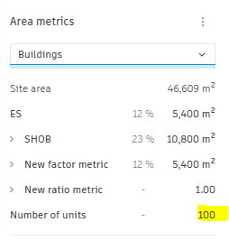
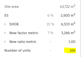
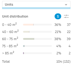
First evaluation: 100 units
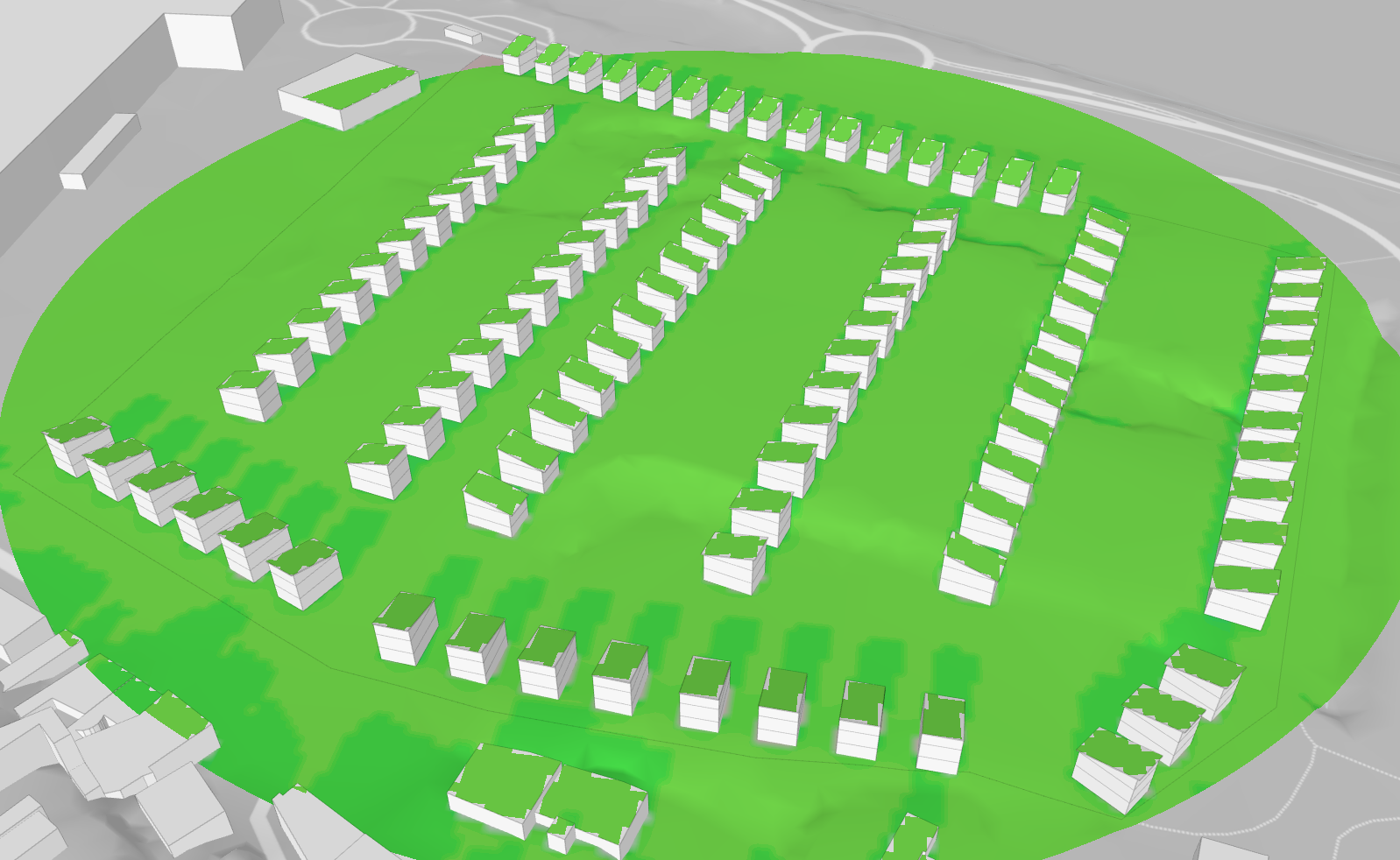
An initial assessment will be conducted based on the requested program of 100 units. This will involve testing two configurations: one consisting of small collective housing units and the other comprising individual houses. The parking requirements for each configuration will also be assessed during this stage.
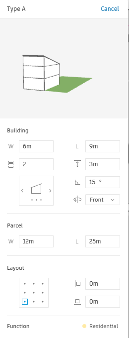
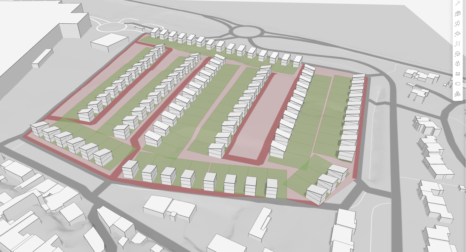
To explore the potential of small collective housing units, a hypothesis will be tested in the initial evaluation. This option could offer several benefits, including increased density, efficient use of land, and the potential for shared amenities and services among residents.
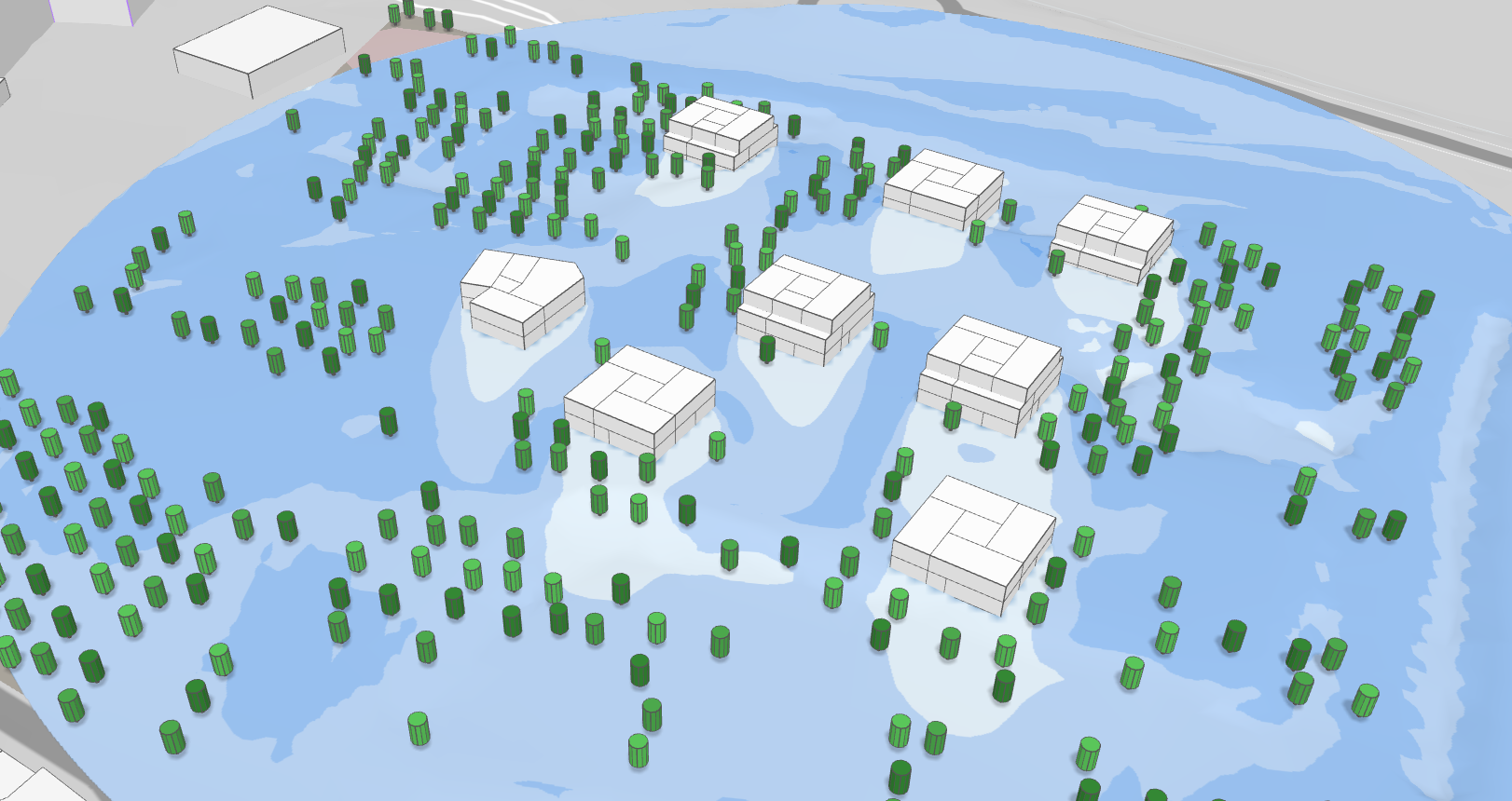
Wind Analysis
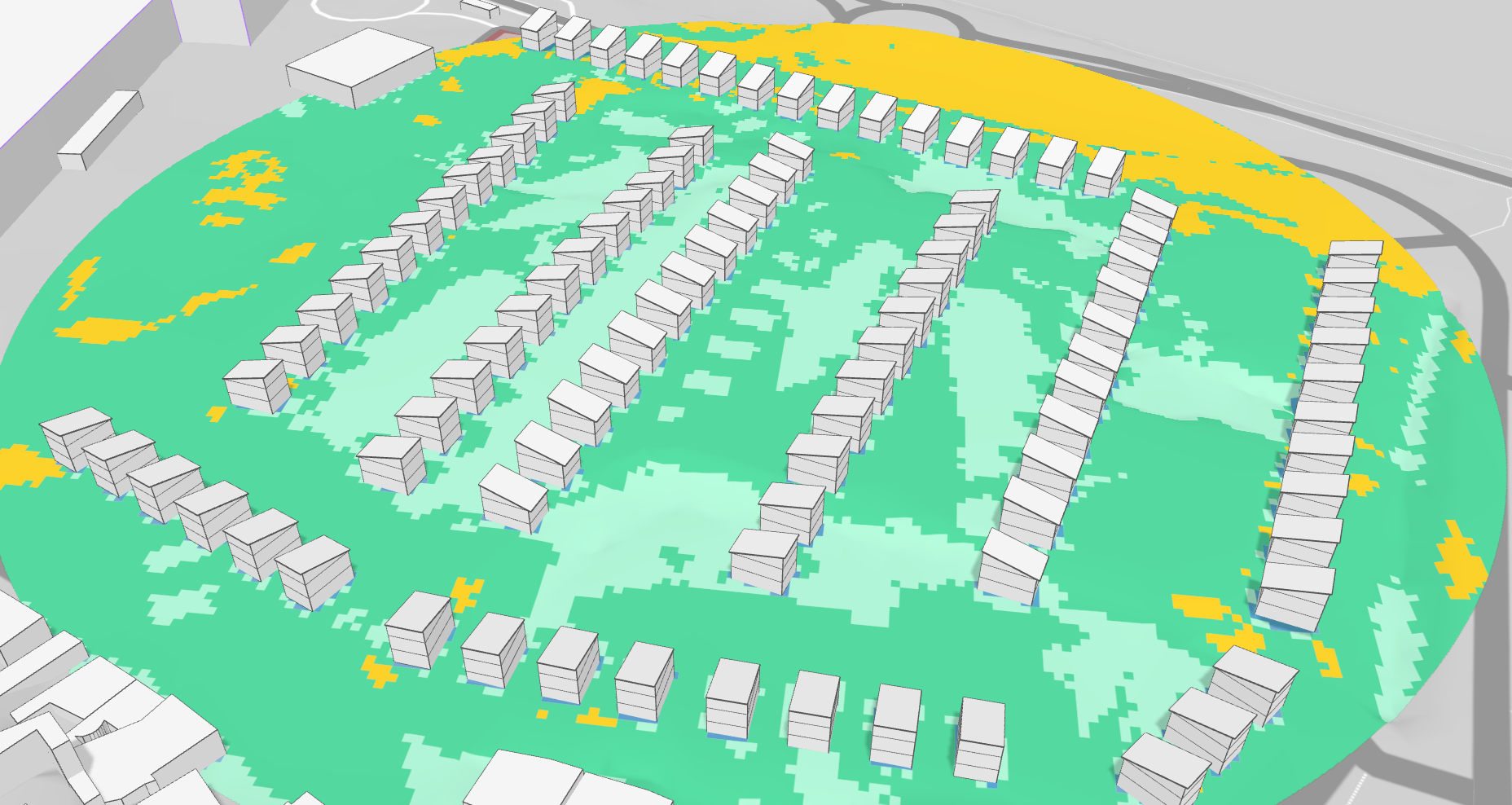
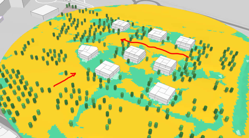
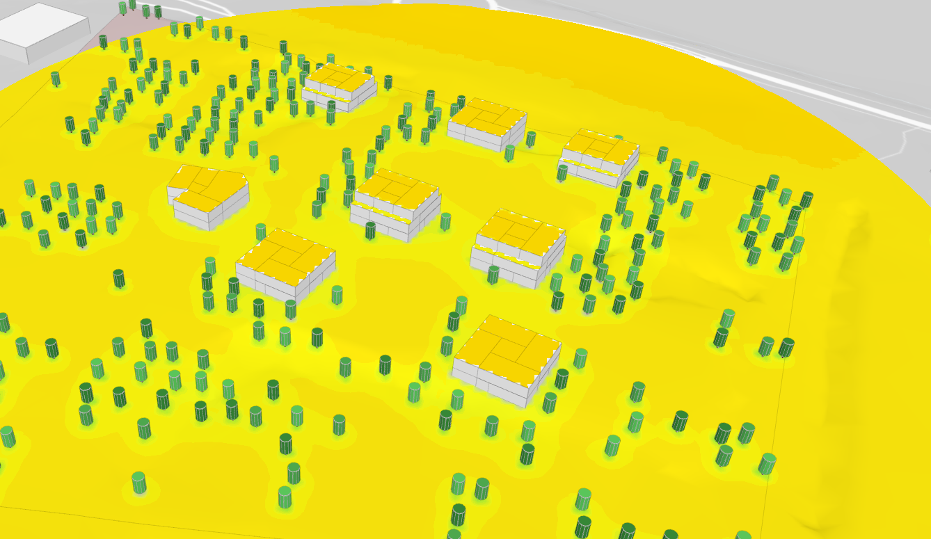
![]() Based on this initial evaluation, it is possible to conduct some preliminary climate assessments, beginning with an analysis of wind patterns. This wind assessment will involve analyzing wind data, modeling wind patterns across the site, and identifying areas that may be particularly exposed or sheltered.
Based on this initial evaluation, it is possible to conduct some preliminary climate assessments, beginning with an analysis of wind patterns. This wind assessment will involve analyzing wind data, modeling wind patterns across the site, and identifying areas that may be particularly exposed or sheltered.
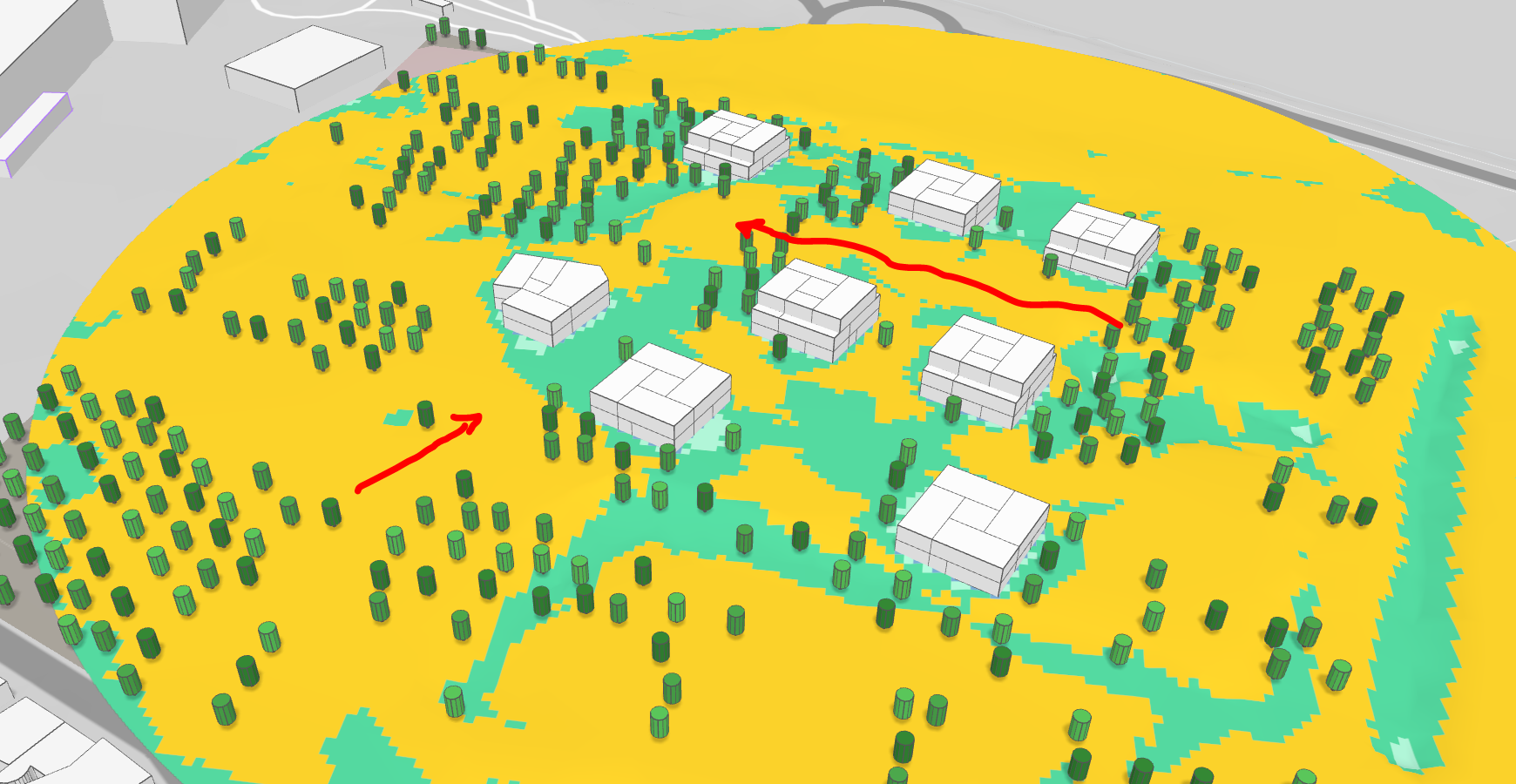
The current configuration includes many exposed spaces, which requires further development based on information provided by the CSTB (Centre Scientifique et Technique du Bâtiment). This will involve analyzing the specific characteristics of these exposed spaces, such as their orientation, size, and intended use, and incorporating design strategies to address potential issues related to climate, noise, or privacy.
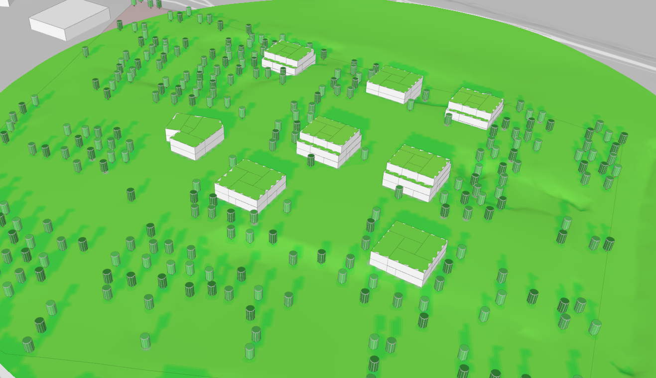
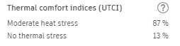
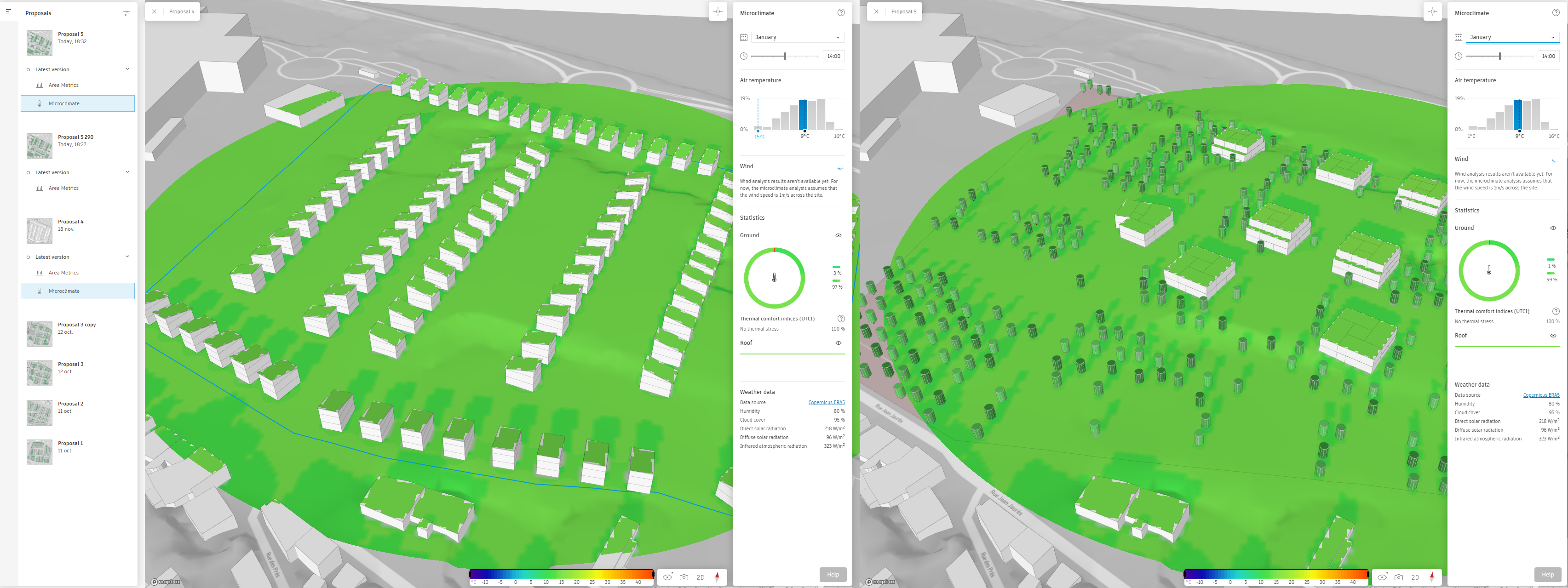
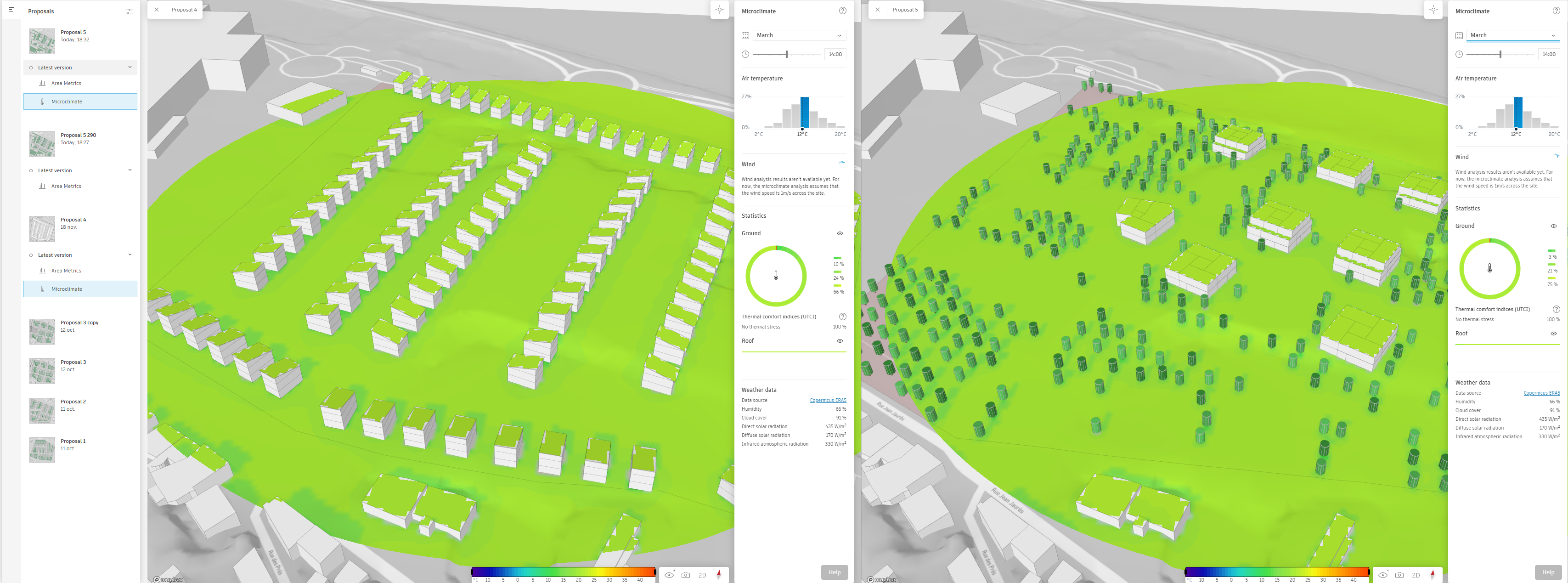
Micro climate
The analysis of the microclimate helps to identify localized heat island effects. However, the results generated are approximate, as the surface materials have not been specified. These findings should be discussed in light of the information provided by the CEREMA (Centre d’Études et d’Expertise sur les Risques, l’Environnement, la Mobilité et l’Aménagement).
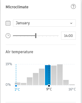
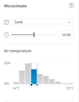 January/June comparison.
Comparison with the housing project
The analysis is conducted using the individual house design. By focusing on this configuration, the team can assess the specific impacts and implications of this typology on the microclimate.
The « Compare » button and function enable users to display the results of various simulations side by side. This feature facilitates a more comprehensive understanding of the different design options and their respective impacts on the microclimate, energy performance, and other key criteria.


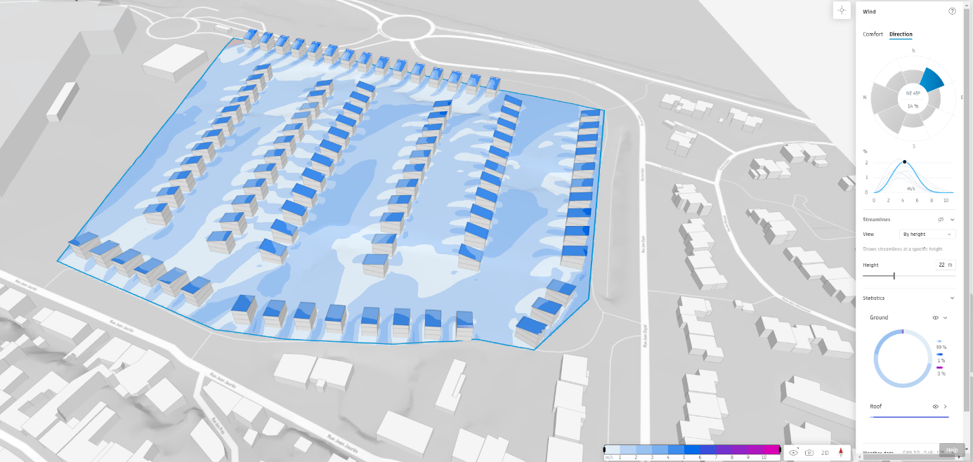
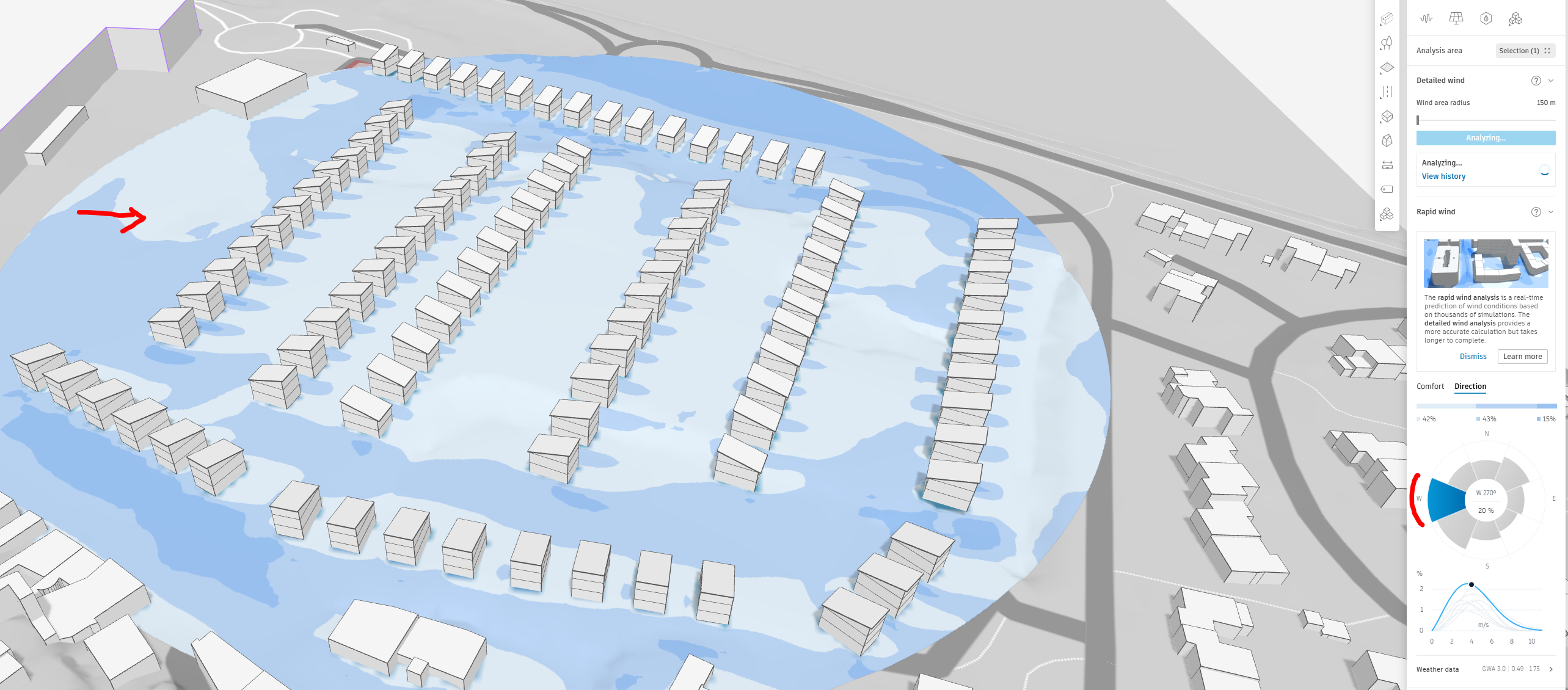
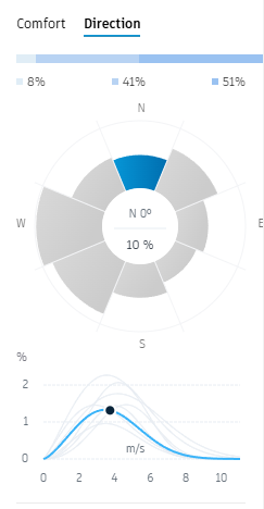
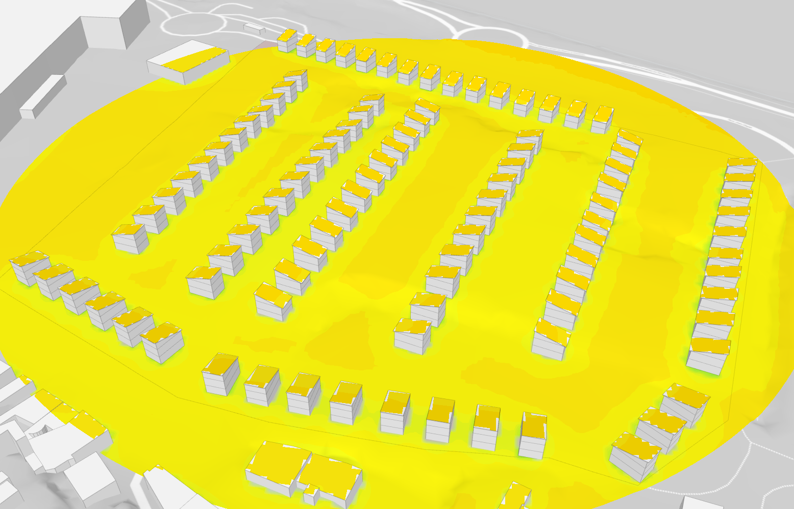
Wind analysis for the 100 units houses
Once again, it is crucial to interpret these results in light of the information provided by the CSTB. The CSTB’s guidance and expertise will enable a more accurate understanding of the simulation results