Pushing the limits
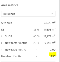
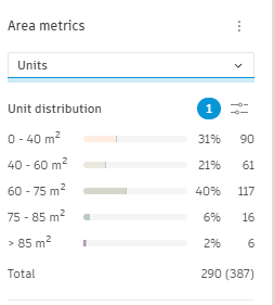
The site has the potential to accommodate a higher density of housing units. In this scenario, 290 dwellings are proposed in the form of small collective housing units. The transition from individual houses to small collective housing units will require careful consideration of various factors, such as building height, massing, and overall site organization.
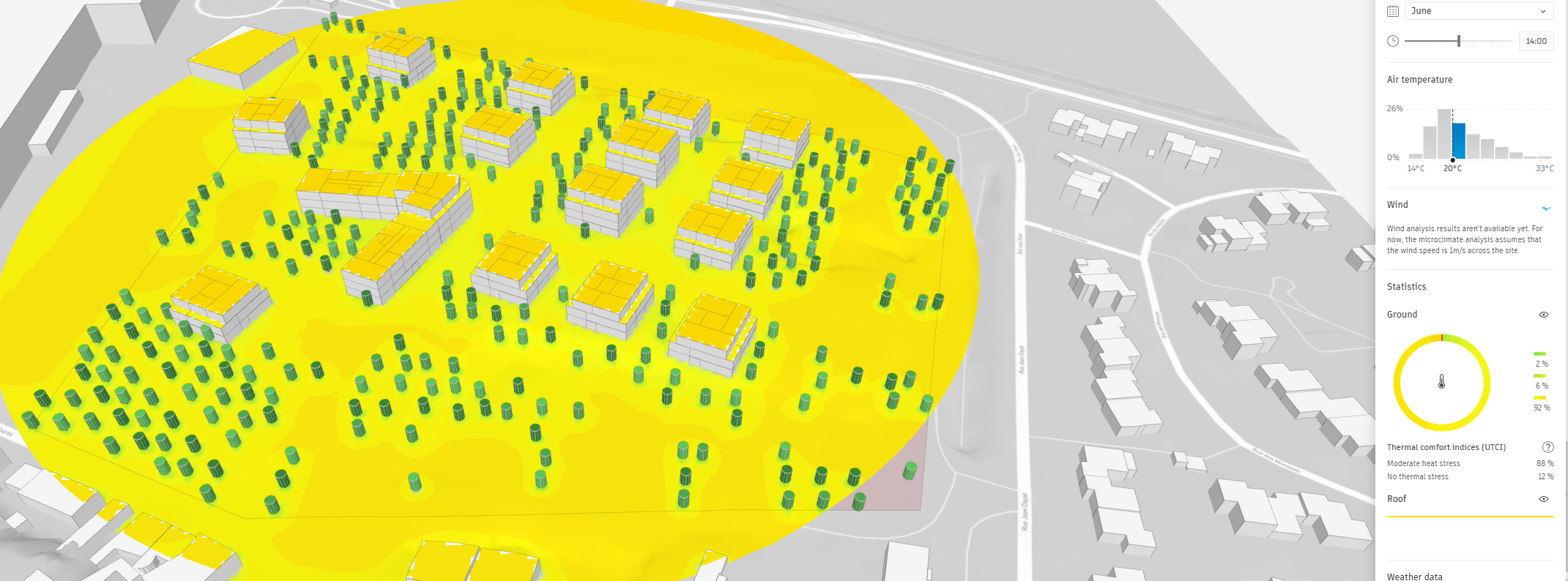
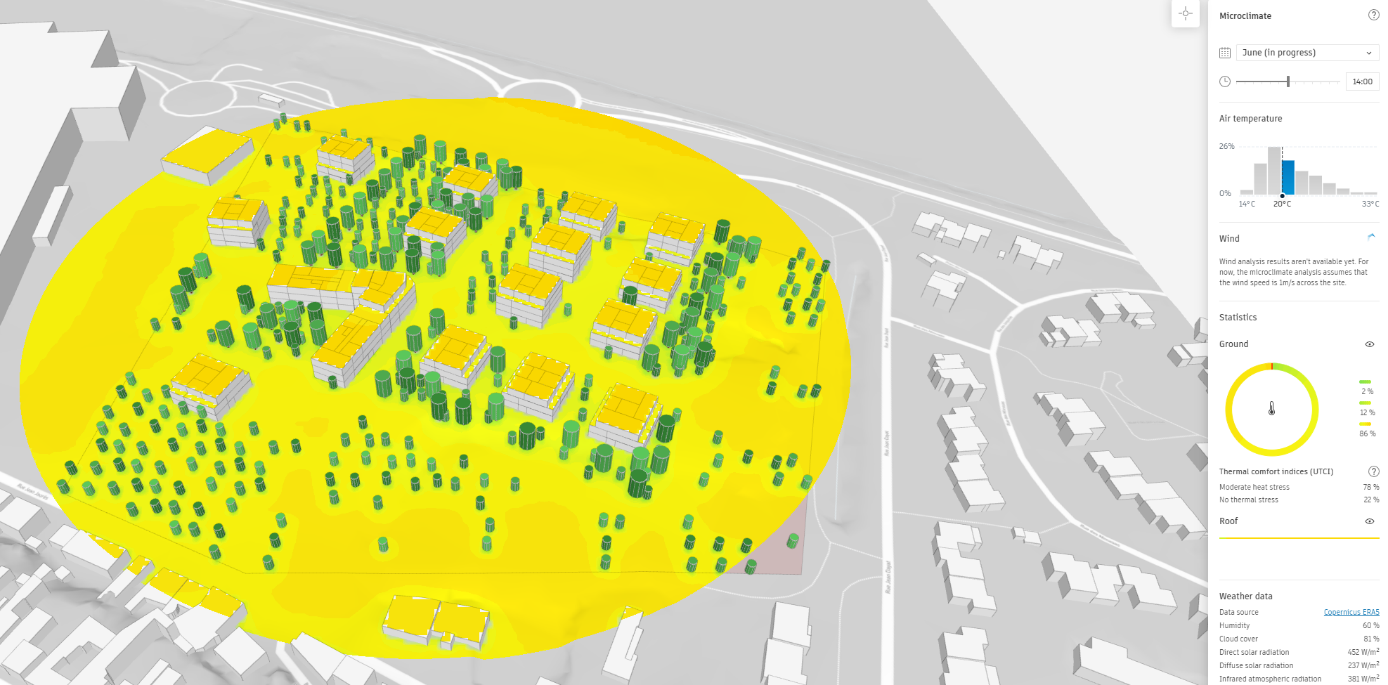
Building on this maximum-density hypothesis, the team will conduct additional climate simulations to identify zones of comfort and discomfort. This analysis will enable the proposal of urban improvements and the selection of the most suitable spaces for various activities, including transportation, children’s playgrounds, sports areas, and more.
By understanding the climatic conditions within the site and how they may affect occupant comfort, the design team can develop targeted strategies for enhancing the overall livability of the development. This might involve the strategic placement of shade structures, windbreaks, or vegetation to mitigate uncomfortable microclimate conditions.
Wind zones
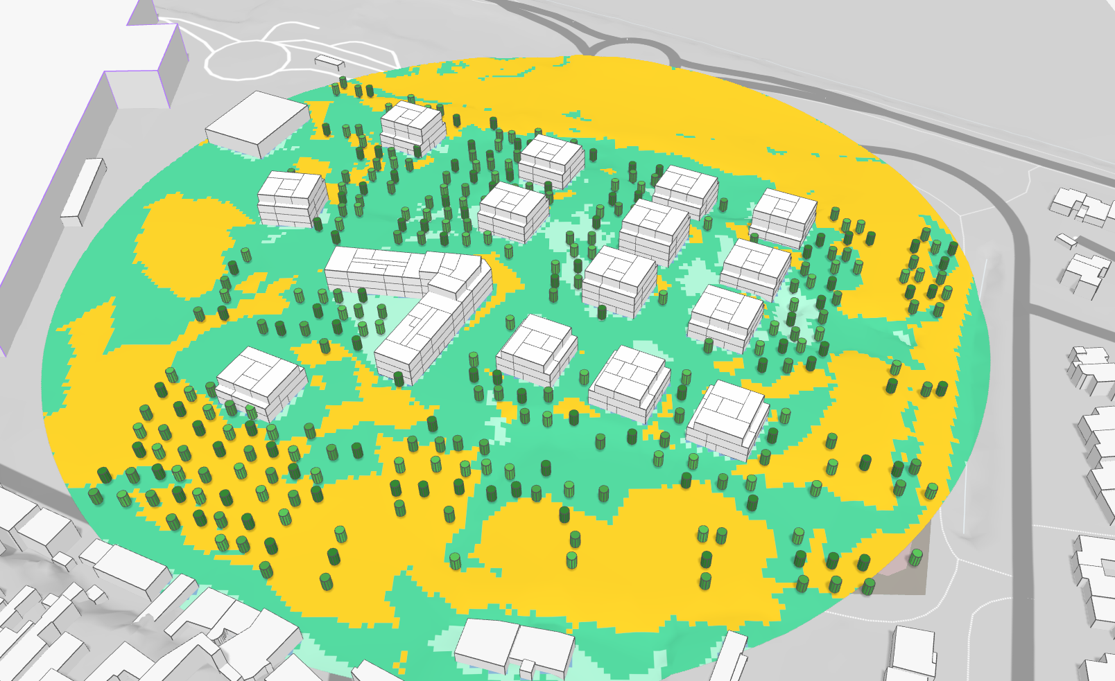
Micro climate
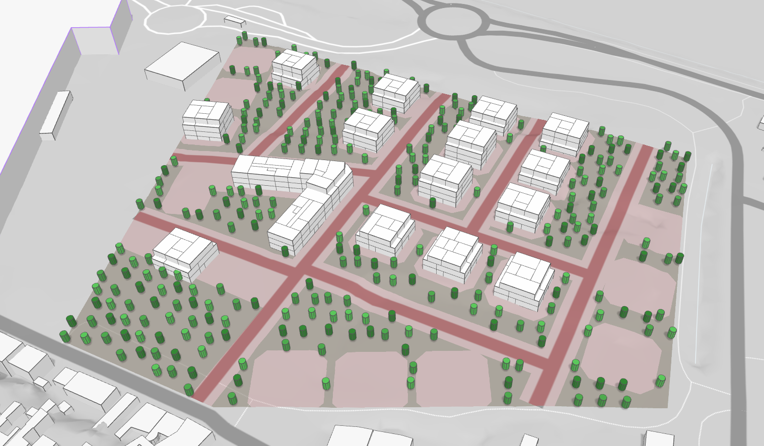
 Adding trees
Daylight potential
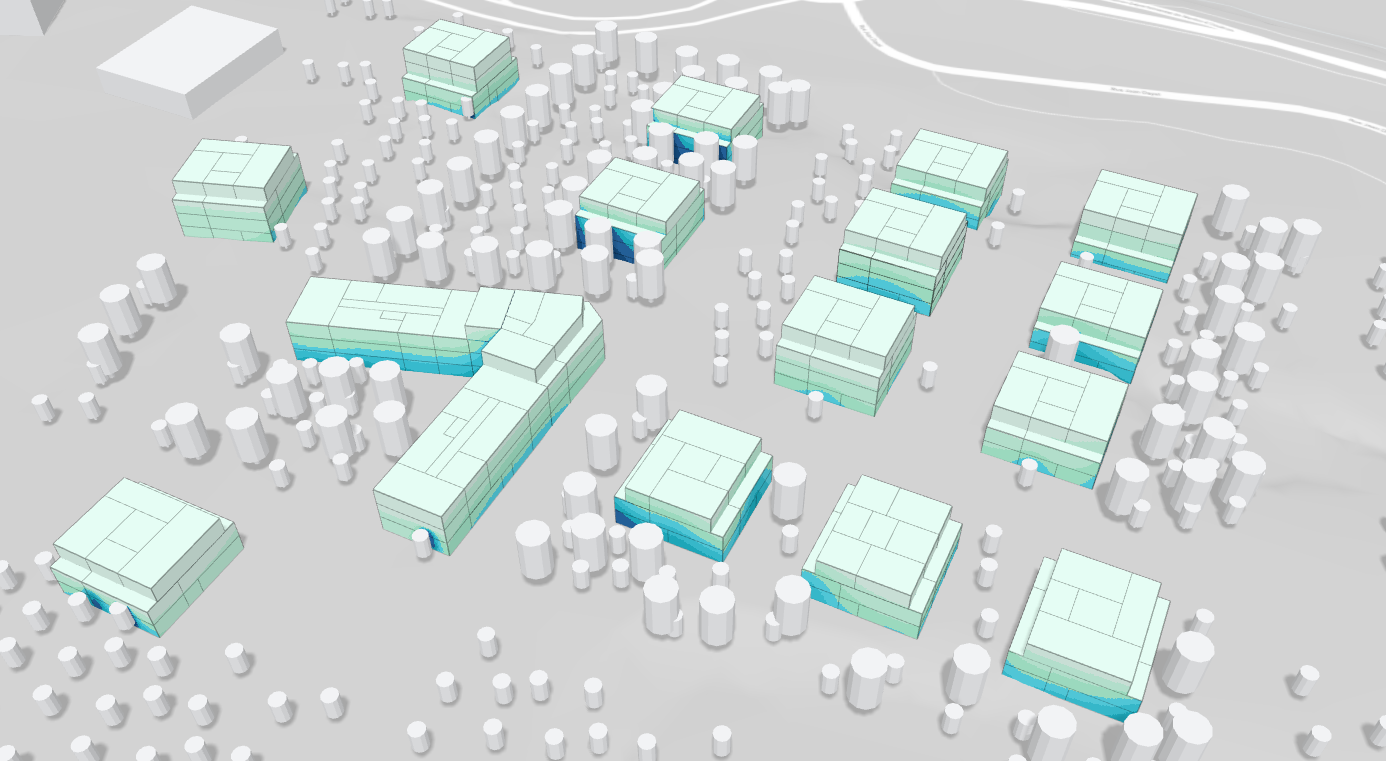
![]() Using the « daylight potential » feature, the team can verify the access to natural light within the site. In the example, the density of trees creates areas that are less exposed to daylight. These design decisions require careful balancing to ensure a comfortable and healthy living environment for residents.
Using the « daylight potential » feature, the team can verify the access to natural light within the site. In the example, the density of trees creates areas that are less exposed to daylight. These design decisions require careful balancing to ensure a comfortable and healthy living environment for residents.
Despite the presence of trees, the distance between buildings appears to guarantee good exposure to daylight. This indicates that the current building layout provides adequate access to natural light for most dwellings, which is essential for occupant well-being and energy efficiency.
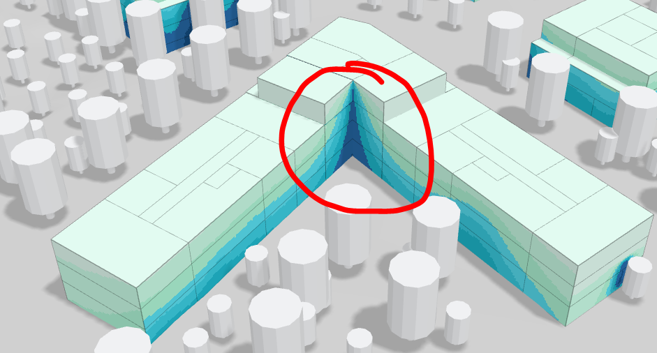
The triangular shape of the buildings may not be maintained due to potential issues with exposure and views. While this form may offer some aesthetic or functional benefits, it could also create undesirable conditions in terms of daylight access and privacy between dwellings.
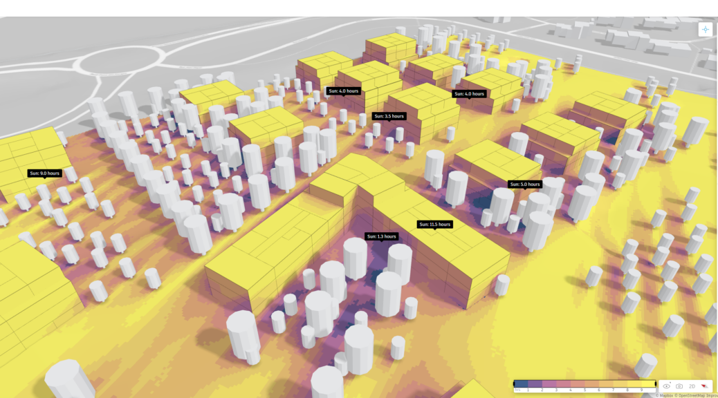
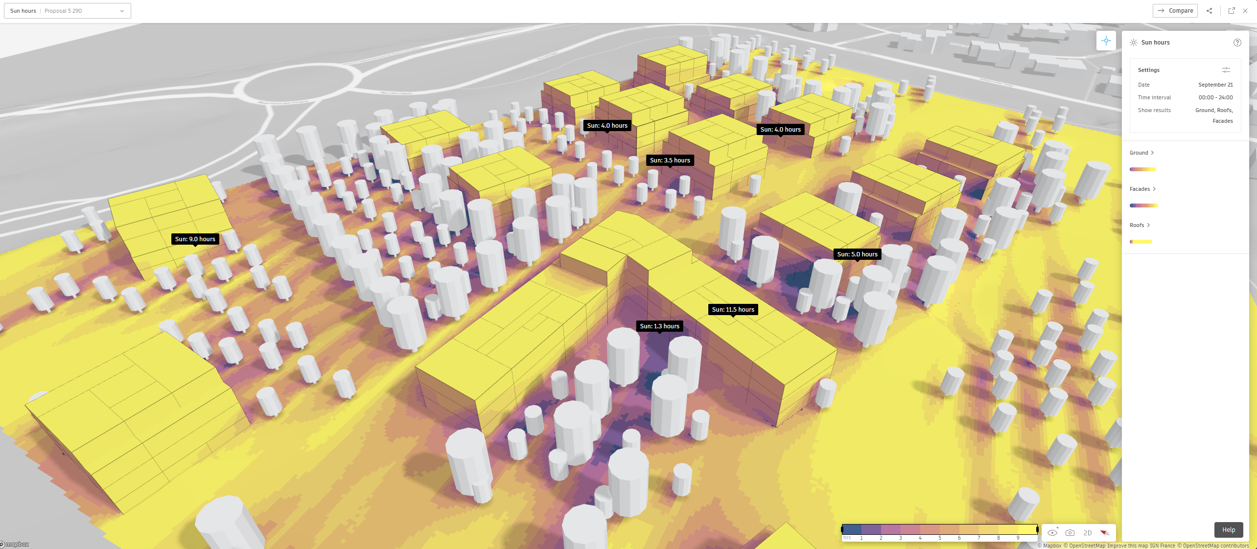
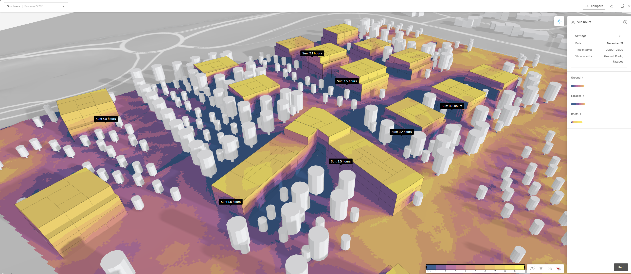
Sun hours
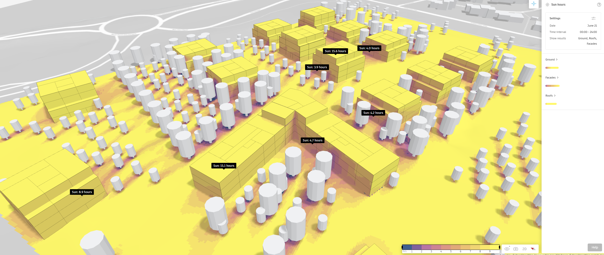
![]() Sun hours allows to quantify the cumulative duration of exposure to direct sunlight at key moments throughout the year, specifically during the equinoxes and solstices. This analysis provides valuable insights into how the development’s orientation, building forms, and landscape elements interact with the sun’s path.
Sun hours allows to quantify the cumulative duration of exposure to direct sunlight at key moments throughout the year, specifically during the equinoxes and solstices. This analysis provides valuable insights into how the development’s orientation, building forms, and landscape elements interact with the sun’s path.
Traffic
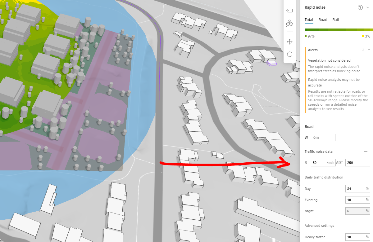
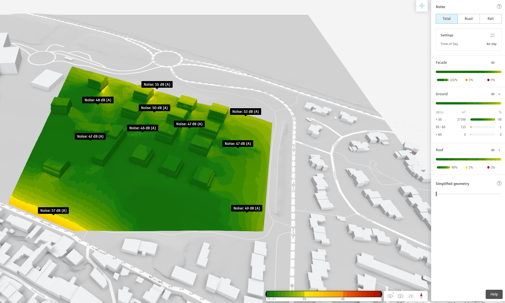
![]() Traffic data can be utilized to calculate the noise pollution levels within the site. Open-source information is available for recorded streets; however, equivalent data may need to be found for unrecorded areas. Key parameters for this analysis include vehicle speed, daily traffic volume, proportion of trucks, and night-time traffic. In this particular case, the primary noise pollution source is the D107 road, from which the development must be protected.
Traffic data can be utilized to calculate the noise pollution levels within the site. Open-source information is available for recorded streets; however, equivalent data may need to be found for unrecorded areas. Key parameters for this analysis include vehicle speed, daily traffic volume, proportion of trucks, and night-time traffic. In this particular case, the primary noise pollution source is the D107 road, from which the development must be protected.